QGIS
QGIS
QGIS is a powerful, user friendly, free and Open Source Geographic Information System (GIS). It runs on Windows, Mac OS X, Linux, Unix, and Android and supports numerous vector, raster, and database formats and functionalities.
At L ~ P : Archaeology we exclusively use QGIS for all our GIS requirements and have developed a number of plugins to support archaeological projects and to integrate with ARK Database. We have released some of these plugins for all archaeologists to benefit from and will release more over time.
Currently these plugins are hosted in our beta testing repository and are marked as experimental, but once stable will be submitted to the main QGIS repository. You are welcome to try out these plugins and to provide feedback, but please be aware that they are in beta and so may still have some bugs. To provide feedback, either open an issue on the plugin's GitHub issue tracker, or email ark@lparchaeology.com.
Setup
To install the plugins you need to add the L ~ P : Archaeology QGIS Plugins repository in your QGIS plugins settings.
- From the Plugins menu choose Manage and Install Plugins
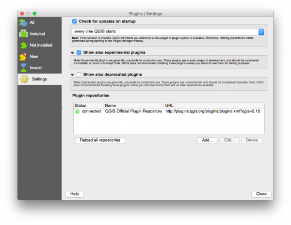
- In the Plugins window choose the Settings tab
- Select the Show also experimental plugins option
- Select the Add... button
- Add the new repository details with the name ARK Plugins and a URL of http://plugins.lparchaeology.com/qgis/plugins.xml
- After clicking OK the repository will be loaded and the new plugins will be listed in the New tab
The Plugins Settings dialog should look similar to this before adding the ARK repository:
The Repository Details dialog should look similar to this:
ARK Clone
A QGIS Plugin to clone existing vector layers as temporary memory layers.
This plugin adds an option to the legend context menu and the main vector menu to clone the current layer. Users can choose to clone just the layer structure, just the selected features, or all the features.
Development of ARK Clone is hosted on GitHub at https://github.com/lparchaeology/ArkClone. You can open an issue at https://github.com/lparchaeology/ArkClone/issues, or email ark@lparchaeology.com.
ARK Grid
A QGIS Plugin to create and work with local site grids as commonly used in archaeology.
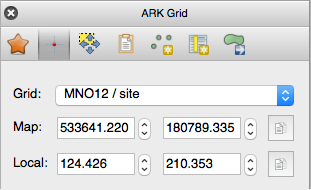
A grid wizard allows you to create grids from two known points, or from a known origin and baseline. Interactive tools are provided to convert between local coordinates and map coordinates.
Development of ARK Grid is hosted on GitHub at https://github.com/lparchaeology/ArkGrid. You can open an issue at https://github.com/lparchaeology/ArkGrid/issues, or email ark@lparchaeology.com.
ARK Snapping
A QGIS Plugin to speed-up snapping configuration.
This plugin is currently in alpha and will be released as beta shortly.
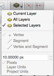
Main Toolbar buttons allow you to quickly switch between All Layers, Current Layer, and Selected Layers, and to toggle Intersection Snapping and Topological Editing:
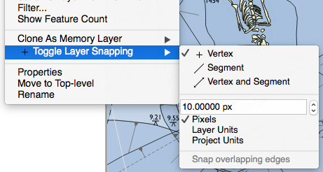
When in Selected Layers mode, the Layer Context Menu allows you to configure snapping on the selected layers.
A panel will list all selected layers and allow for more detailed configuration.
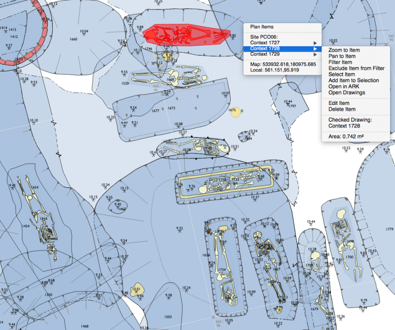
ARK Spatial
A QGIS Plugin to record and query archaeological spatial data.
This plugin is currently in alpha and will be released as beta shortly.
Features include:
- Simplified geo-referencing of permatrace to a site grid or baseline
- Rapid digitising of archaeological plans and sections using MoLA drawing conventions
- Powerful query and filter tools working at Context level
- Post-excavation checking workflow and reports
- Live data link to an ARK Database
